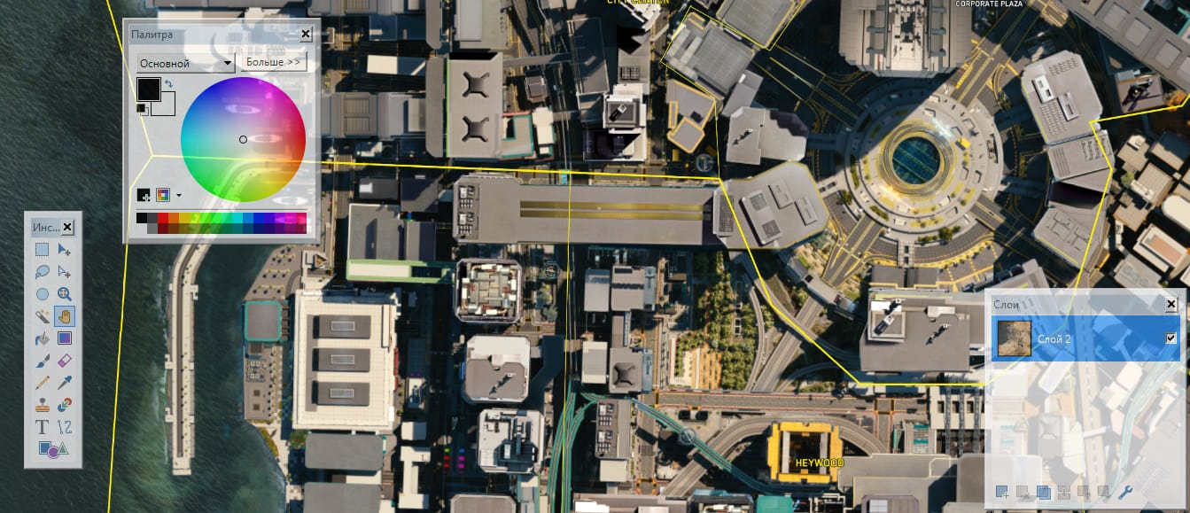

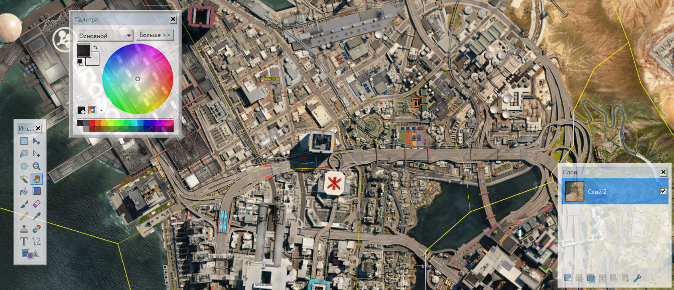
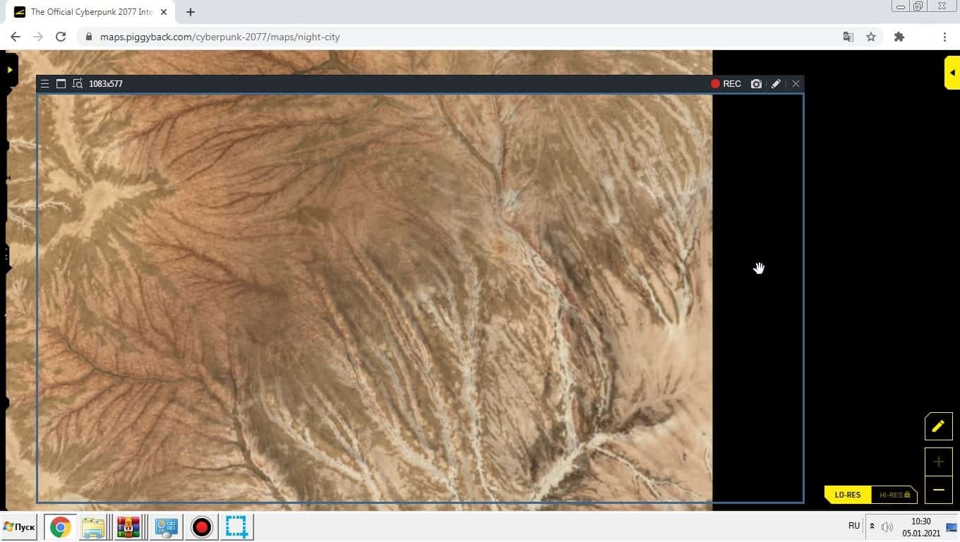
The Official LO-RES
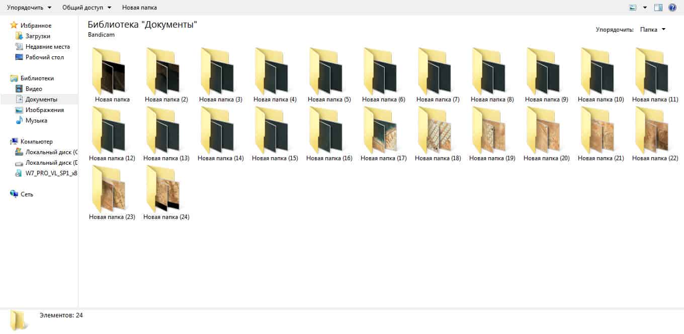
I photographed the maximum size (Official LO-RES) and glued together about 500 photos (the size of each of my photos was 1083 * 577).
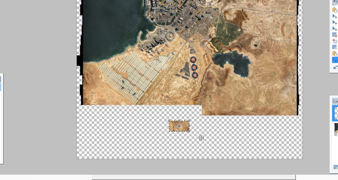
I ended up with the clearest map on the internet because it consists of 12300 * 12700 pixels.
12300 * 12700 pixels.
I didn’t steal. My map has errors due to gluing (be careful), and it is very high-quality (12300 * 12700 pixels), unlike the one you downloaded from another site.
16 hours spent
My template for editing in the program paint.net located in the zip archive.
Used +500 photos (1083 * 577)
Since it was difficult to glue, I periodically update it. Already great!